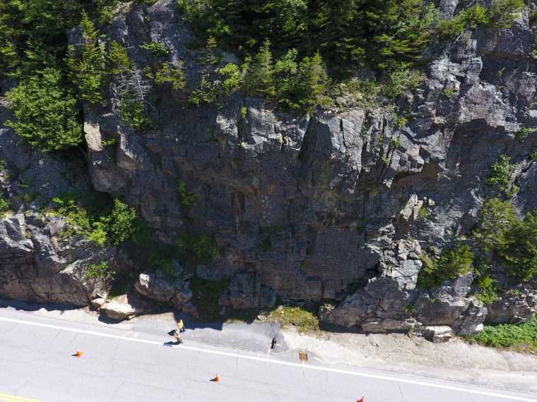
In northern New Hampshire, many roads were cut through hills and mountains, which means steep granite-based slopes must be maintained for safety. Addressing this problem is time consuming and expensive for NHDOT as the picturesque yet dangerous rock cuts are exposed to harsh New England weather and must be frequently stabilized before they crack off and crash down onto busy NH roadways. Ultimately, the agency needed a better way to keep track of rock slop conditions.
Working with the University of Vermont, NHDOT employed an Unmanned Aerial System (UAS) or “drone” mounted camera to create a georeferenced point cloud of a rock slope using the photogrammetry technique known as “structure from motion.” Those images are then put into a 3D modeling and visualization program to analyze rock structure and slope stability. This saves the department time, money, and stress, as manual measurement of rock structure information takes a lot of time and can be dangerous to workers. With the use of the $1.78 million UAS program, NHDOT can now keep both road users and employees safe while having a full understanding of the environment around the roadways.